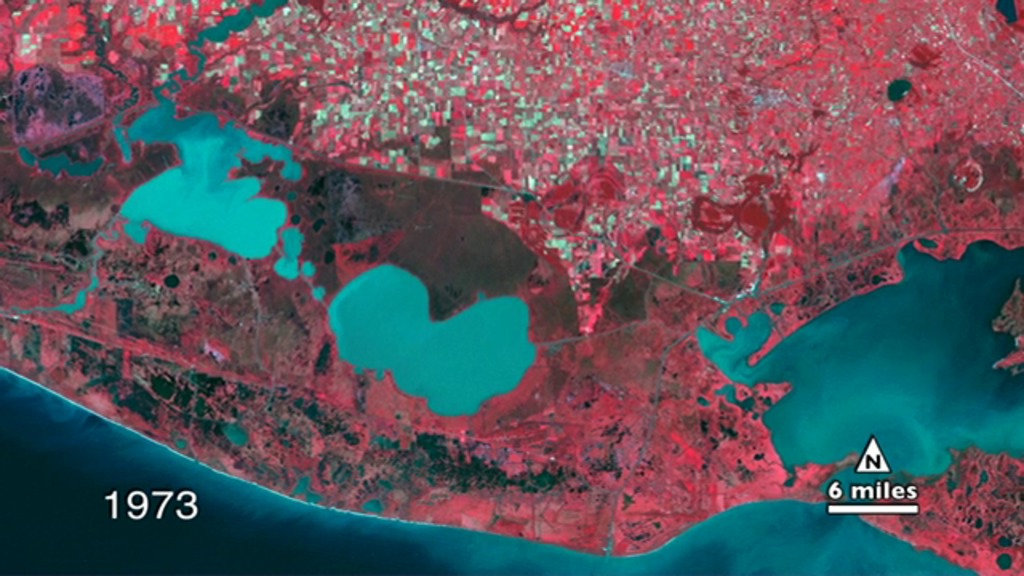
Timelapse of six years in southern Vermilion Parish, Louisiana (1973, 1980, 1986, 1992, 2003, 2010) land being overtaken by water. In these images from Landsat data, red indicates healthy vegetation and shades of blue indicate water.
> CONTACT & ABUSE <